Remote Sensing
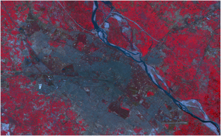
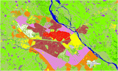
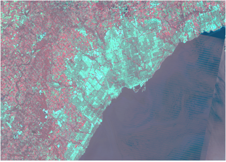
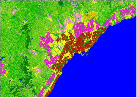
Geospatial service extensive experience in satellite image interpretation and processing, having worked with most of the commercially available satellite data products(0.5 mts to 35mts resolution images). Geo Spatial Team has enormous experience in Image classification, rectification, interpretation, etc., for Land Use and Land Cover mapping. We use our proprietary methodology to derive valuable and accurate information for a wide range of applications such as mineral mapping, utility planning, natural resource mapping, watershed management, Telecom application and land use planning, amongst others.